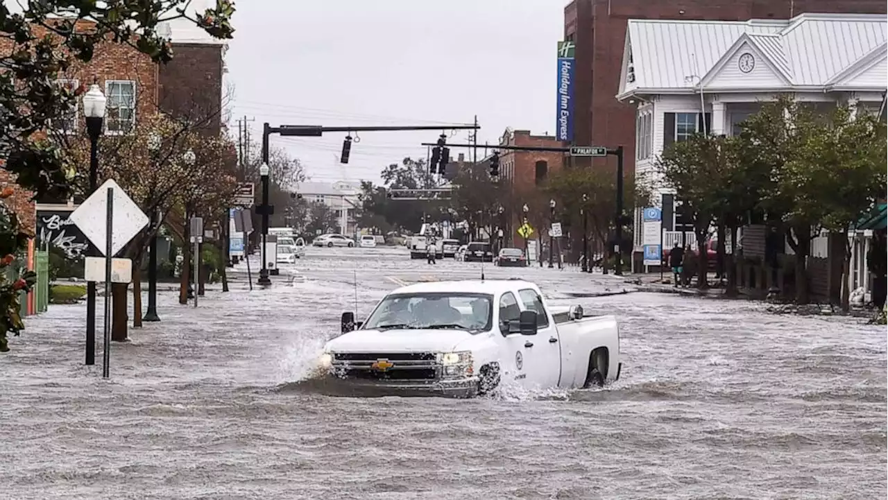
NOAA has an experimental storm surge forecast which calls for roughly 5-10 feet of surge pushing into the Tampa Bay area, 4-7 feet for Port Charlotte, and 3-5 feet for the Everglades.
A Storm Surge Watch is in effect for the Florida Keys from the Card Sound Bridge westward to Key West, Dry Tortugas, Florida Bay, Anclote River southward to the Card Sound Bridge, and Tampa Bay.A Storm Surge Watch means there is a possibility of life-threatening inundation, from rising water moving inland from the coastline, in the indicated locations during the next 48 hours.
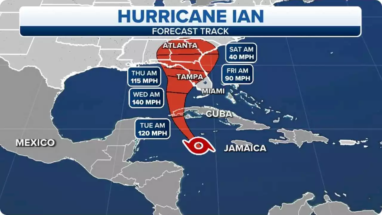
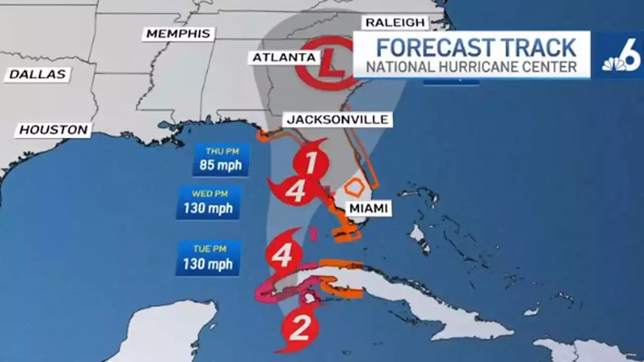
If the highest surge were to occur during high tide, the water levels would climb quickly. A dangerous combination. Looking ahead, Tampa Bay will see high tide Wednesday night at 5:32 p.m, and 4:25 a.m. Thursday morning. During this time Ian is forecast to be a major hurricane right off the coast. This is why the forecast calls for 5-10 feet of surge.The Florida Keys are forecast to see 4 to 6 inches.The remainder of the Florida Peninsula: 3 to 8 inches. Heavy rainfall is expected to affect North Florida, eastern portions of the Florida Panhandle, and portions of the Southeastern U.S. Friday and Saturday.
Argentina Últimas Noticias, Argentina Titulares
Similar News:También puedes leer noticias similares a ésta que hemos recopilado de otras fuentes de noticias.
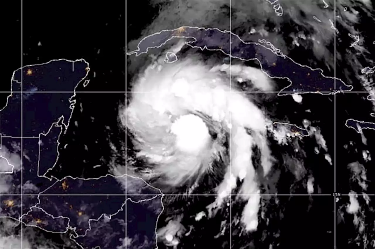
 Hurricane Ian forms in Caribbean, prompting Hurricane Watch for Florida's Gulf Coast, including Tampa BayA Hurricane Watch has been issued along Florida's Gulf Coast ahead of the expected wind, rain, and storm surge from Hurricane Ian later this week.
Leer más »
 Hurricane Ian: Why the Gulf Coast -- especially in Florida -- is so vulnerable to hurricanes, storm surgeAs Hurricane Ian marches closer to the U.S., its aim toward the Gulf Coast is especially concerning considering how vulnerable the region is to storm surge.
Leer más »
 'Impacts are going to be far and wide': DeSantis urges entire Gulf Coast to prepare for Ian“Floridians up and down the Gulf Coast should feel the impacts of this,' DeSantis said during a press conference at the Emergency Operations Center. “This is a really, really big hurricane at this point.” DeSantis noted Ian is about 500 miles wide.
Leer más »
 Hurricane Ian on Path to Strike Florida as a Category 4 StormEvacuations were underway along Florida’s Gulf Coast Monday as Hurricane Ian formed and was quickly strengthening and expected to become a dangerous Category 4 hurricane before possible landfall later in the week.
Leer más »
 Tropical Storm Ian's uncertain path has all of Florida preparing for a major hurricaneIts exact path still uncertain, Tropical Storm Ian strengthened Sunday night as it churned in the Caribbean, threatening to arrive in Florida as a hurricane packing powerful winds and dangerous storm surge.
Leer más »
![]() Hurricane Ian tracker: Potentially 'life-threatening' Category 1 storm on path toward FloridaHurricane Ian strengthened overnight and was upgraded to a Category 1 hurricane as its exact track remains uncertain.
Hurricane Ian tracker: Potentially 'life-threatening' Category 1 storm on path toward FloridaHurricane Ian strengthened overnight and was upgraded to a Category 1 hurricane as its exact track remains uncertain.
Leer más »