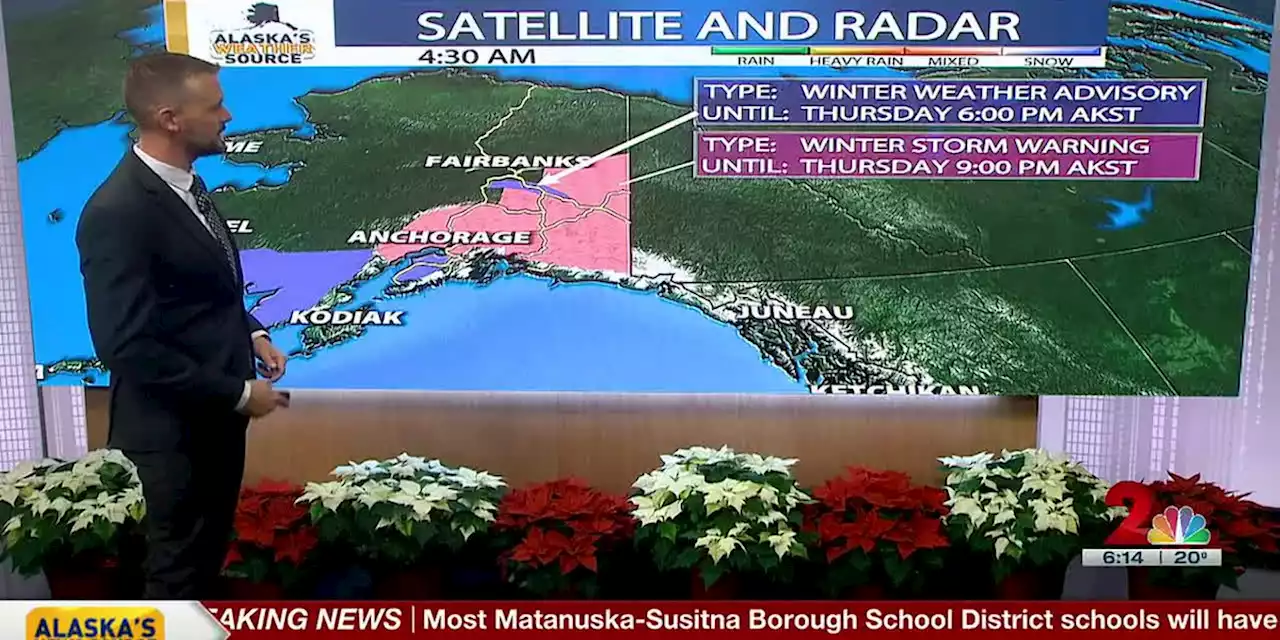
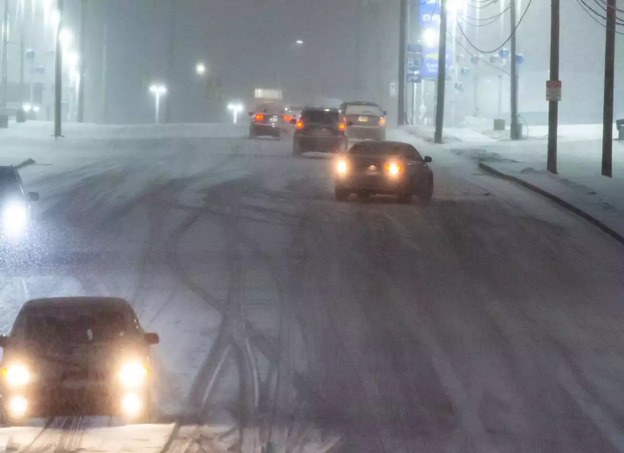
The heaviest snow will fall overnight Wednesday into Thursday morning.
ANCHORAGE, Alaska - It’s Groundhog Day again, as the never-ending cycle of snow continues to slam into Southcentral Alaska. With only half of the month gone, Anchorage has already secured itself into the top 10 in terms of snowfall in December. With a healthy snow depth of just under 3 feet, more snow moving into Southcentral could cause issues.
There’s good news for inland regions of Southcentral, as the track of the low will limit if we’ll see any wintry mix make it inland. Should it occur, it most likely will happen for areas near the Knik Arm. While the threat is there for a brief wintry mix into the evening, the vast majority of the region will see all snow. This system doesn’t look to bring record daily snowfall to the region, but many areas could see an additional 5 to 14 inches across Southcentral.
With that said, Thursday could be another day where you shouldn’t be on the roads if you don’t have to. Should you venture out these are the impacts one can expect to experience through Thursday morning.Visibility issues in some of the heavier snow bands and heavy traffic areas.Slick or icy conditions in areas that manage to see a wintry mix through the night.
Argentina Últimas Noticias, Argentina Titulares
Similar News:También puedes leer noticias similares a ésta que hemos recopilado de otras fuentes de noticias.
 Strong To Severe Storms Likely Wednesday Afternoon Into Early Thursday - Alabama NewsWe’re designating Wednesday afternoon into Thursday morning as a CODE RED day! We expect storms to develop ahead and along a strong cold front plowing into the deep south. The main threats will be damaging winds up to 60 mph, a few tornadoes, and heavy rainfall leading to flash flooding. Rainfall potential will range between 1 to 3 inches. Everyone...
Leer más »
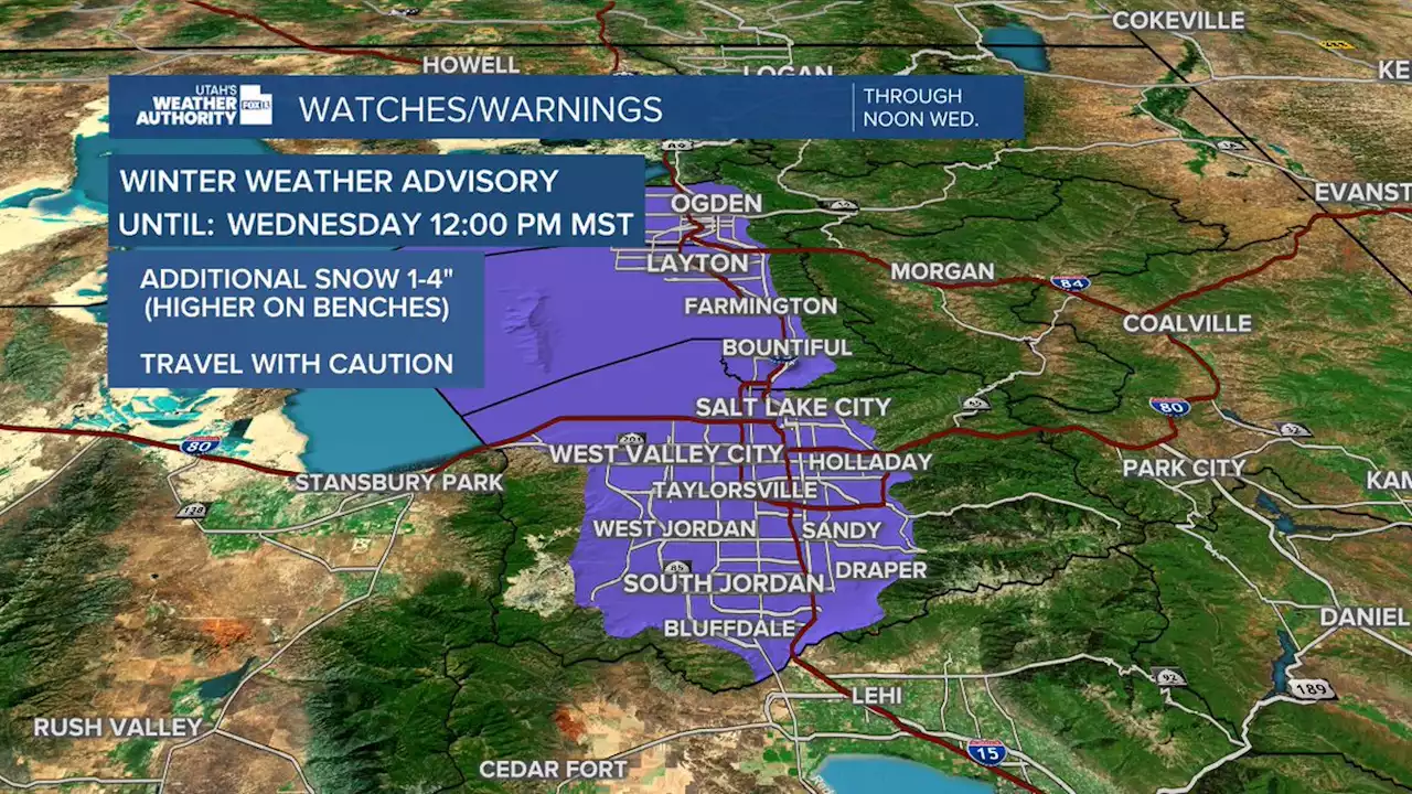 Winter Storm Advisory extended into Wednesday as more snow expectedSnow continued Monday night into Tuesday, making for some slick roads and tough visibility as many cities were covered in a blanket of white.
Leer más »
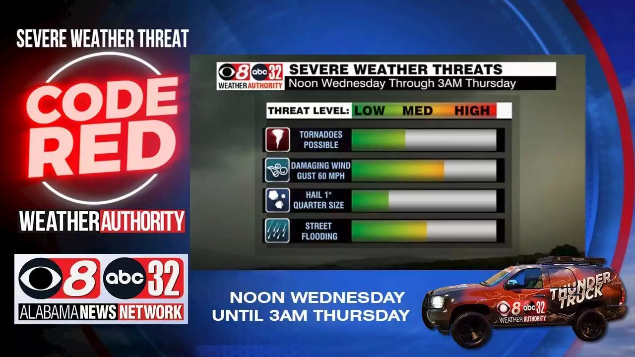 CODE RED: Severe Weather Threat Wednesday Afternoon-Early Thursday - Alabama NewsAlabama News Network's Weather Authority team is tracking severe weather that will be moving into our area starting Wednesday afternoon. Our meteorologists have issued a Code Red Alert. alabamanewsnetwork
Leer más »
 Colorado traffic: Many northeast plains highways still closed Wednesday due to winter stormMost roads shut down Tuesday in the northeast plains during the severe winter storm that caused blizzard conditions are still closed Wednesday as high winds continue to batter the area.
Leer más »
 Winter weather advisory warns central Pa. will get snow, sleet and wind gusts ThursdayA winter weather advisory is in effect between 1 a.m. and 7 p.m. Thursday.
Leer más »