Ian 11pm Tue Update: Cat 3 with winds of 120 mph. Tropical Storm and Storm Surge Warning continues for parts of the area Forecast cone has again shifted S & E Landfall near Ft. Myers becoming likely Local impacts Wed-Thu-Fri UPDATE:
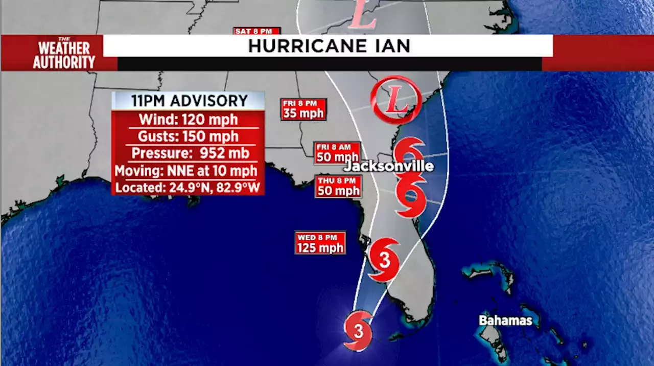
At 11 p.m., the center of Hurricane Ian was located near latitude 24.9 North, longitude 82.9 West. Ian is moving toward the north-northeast near 10 mph . This general motion with a reduction in forward speed is forecast tonight and Wednesday.
On the forecast track, the center of Ian is expected to pass west of the Florida Keys later Tuesday night and approach the west coast of Florida within the hurricane warning area on Wednesday and Wednesday night. Maximum sustained winds are near 120 mph with higher gusts. Ian is a Category 3 hurricane on the Saffir-Simpson Hurricane Wind Scale. Strengthening is expected until the hurricane makes landfall. Ian is forecast to approach the west coast of Florida as an extremely dangerous major hurricane.
Hurricane-force winds extend outward up to 40 miles from the center and tropical-storm-force winds extend outward up to 140 miles .Dry TortugasFlagler/Volusia line to the mouth of the St. Marys RiverCuban provinces of La Habana, Mayabeque, and Matanzas